
Concepcion topographic map
Interactive map
Click on the map to display elevation.
About this map
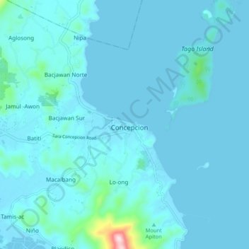
Name: Concepcion topographic map, elevation, terrain.
Location: Concepcion, Iloilo, Western Visayas, 5013, Philippines (11.17563 123.06711 11.25563 123.14711)
Average elevation: 85 ft
Minimum elevation: -3 ft
Maximum elevation: 1,375 ft
Other topographic maps
Click on a map to view its topography, its elevation and its terrain.
Magais Island
Philippines > Iloilo > Concepcion > Talotu-an
Magais Island, Talotu-an, Concepcion, Iloilo, Western Visayas, Philippines
Average elevation: 7 ft