
Villa Libertad topographic map
Interactive map
Click on the map to display elevation.
About this map
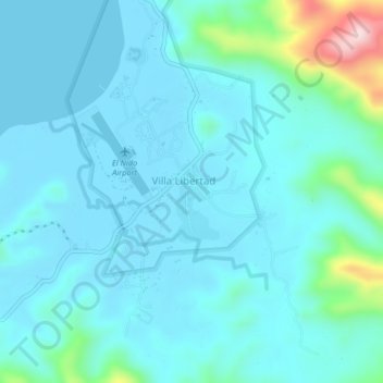
Name: Villa Libertad topographic map, elevation, terrain.
Location: Villa Libertad, Palawan, Mimaropa, 5313, Philippines (11.17738 119.40454 11.21738 119.44454)
Average elevation: 144 ft
Minimum elevation: -10 ft
Maximum elevation: 1,066 ft
Other topographic maps
Click on a map to view its topography, its elevation and its terrain.
Lio Beach, El Nido
Philippines > Palawan > Villa Libertad
Lio Beach, El Nido, Villa Libertad, Palawan, Mimaropa, 5313, Philippines
Average elevation: 33 ft