
Las Cuevas topographic map
Interactive map
Click on the map to display elevation.
About this map
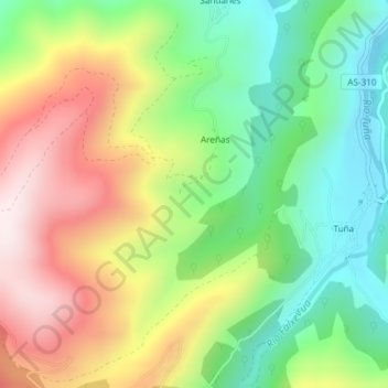
Name: Las Cuevas topographic map, elevation, terrain.
Location: Las Cuevas, Tineo, Asturias, 33876, España (43.26503 -6.39686 43.28503 -6.37686)
Average elevation: 1,552 ft
Minimum elevation: 715 ft
Maximum elevation: 2,664 ft
Other topographic maps
Click on a map to view its topography, its elevation and its terrain.
Pena el Caleyo
España > Asturias > Tineo > Tineo
Pena el Caleyo, Tineo, Asturias, 33870, España
Average elevation: 2,805 ft