
Karamürsel topographic map
Interactive map
Click on the map to display elevation.
About this map
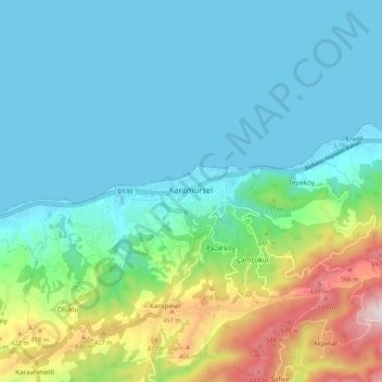
Name: Karamürsel topographic map, elevation, terrain.
Location: Karamürsel, Kocaeli, Marmara Region, 41500, Turkey (40.65090 29.57676 40.73090 29.65676)
Average elevation: 522 ft
Minimum elevation: -3 ft
Maximum elevation: 2,352 ft