Geolocate

Mobile topographic map

Click on the map to display elevation.

About this map

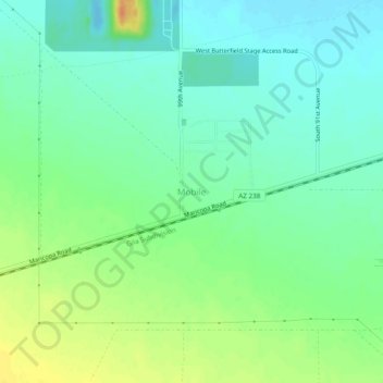
Name: Mobile topographic map, elevation, terrain.

Location: Mobile, Maricopa County, Arizona, 85329, United States (33.03798 -112.29046 33.07798 -112.25046)

Average elevation: 1,319 ft

Minimum elevation: 1,273 ft

Maximum elevation: 1,398 ft

Maricopa County trails, hiking, mountain biking, running and outdoor activities

Gear up for your next adventure:

🧴Hand Sanitizer - Keep hands clean while hiking
🌧️Backpack Rain Cover - Keep gear dry in wet weather
💧Water Purification System - Clean water on the trail with reliable purifiers
🎒Trekking Poles - Sturdy poles for balance and stability on rough terrain
🪶Wildlife Field Guides - Learn animal tracking and species ID

As an Amazon Associate, this site earns from qualifying purchases at no extra cost to you.