
Wanne topographic map
Interactive map
Click on the map to display elevation.
About this map
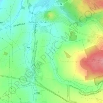
Name: Wanne topographic map, elevation, terrain.
Location: Wanne, Petersberg, Landkreis Fulda, Hesse, 36160, Allemagne (50.55017 9.75941 50.56616 9.77440)
Average elevation: 1,106 ft
Minimum elevation: 991 ft
Maximum elevation: 1,302 ft