
Egersund topographic map
Interactive map
Click on the map to display elevation.
About this map
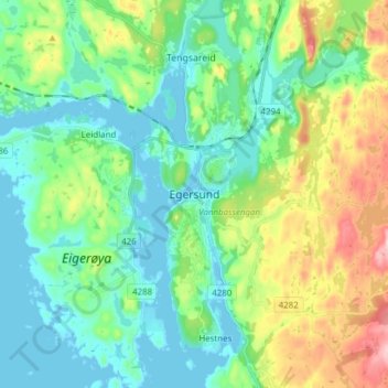
Name: Egersund topographic map, elevation, terrain.
Location: Egersund, Eigersund, Rogaland, 4370, Norway (58.41190 5.96000 58.49190 6.04000)
Average elevation: 220 ft
Minimum elevation: -7 ft
Maximum elevation: 771 ft