
Hokonui Hills topographic map
Interactive map
Click on the map to display elevation.
About this map
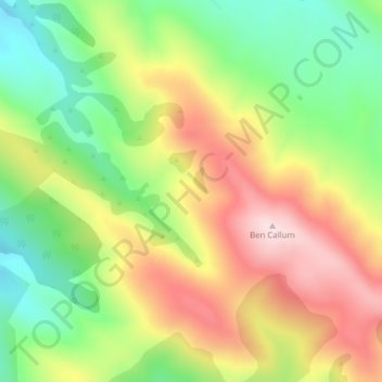
Name: Hokonui Hills topographic map, elevation, terrain.
Location: Hokonui Hills, Invercargill, Southland, New Zealand (-45.94487 168.50515 -45.94477 168.50525)
Average elevation: 1,480 ft
Minimum elevation: 922 ft
Maximum elevation: 2,110 ft
Other topographic maps
Click on a map to view its topography, its elevation and its terrain.
Taramoa
New Zealand > Invercargill > Taramoa
Taramoa, Invercargill, Southland, New Zealand
Average elevation: 26 ft
Waitokariro Lagoon
Waitokariro Lagoon, Invercargill, Invercargill City, Southland, New Zealand
Average elevation: 23 ft
Ruapuke Islands
Ruapuke Islands, Invercargill, Southland, New Zealand
Average elevation: 13 ft
Tauatemaku Lagoon
Tauatemaku Lagoon, Invercargill, Invercargill City, Southland, New Zealand
Average elevation: 16 ft