
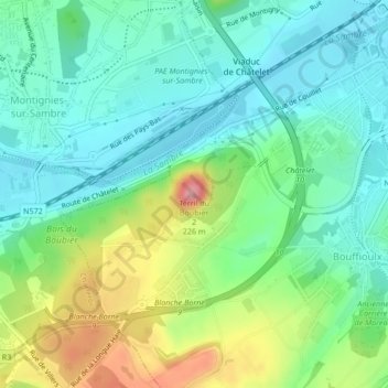
Terril du Boubier 2 topographic map
Interactive map
Click on the map to display elevation.
About this map
Name: Terril du Boubier 2 topographic map, elevation, terrain.
Location: Terril du Boubier 2, Châtelet, Wallonie, 6200, Belgique (50.39449 4.49731 50.39459 4.49741)
Average elevation: 449 ft
Minimum elevation: 312 ft
Maximum elevation: 764 ft