
冷水江市 topographic map
Interactive map
Click on the map to display elevation.
About this map
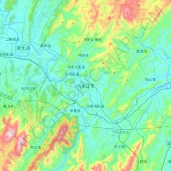
Name: 冷水江市 topographic map, elevation, terrain.
Location: 冷水江市, 娄底市, 湖南省, 中国 (27.49813 111.29347 27.81813 111.61347)
Average elevation: 1,165 ft
Minimum elevation: 492 ft
Maximum elevation: 3,704 ft
全市地形以丘陵为主,年平均气温16℃,降水量1418毫米。