
Mazcuerras topographic map
Interactive map
Click on the map to display elevation.
About this map
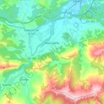
Name: Mazcuerras topographic map, elevation, terrain.
Location: Mazcuerras, Saja-Nansa, Cantabria, 39509, España (43.24653 -4.24629 43.33208 -4.11351)
Average elevation: 1,010 ft
Minimum elevation: 262 ft
Maximum elevation: 2,917 ft