
Thank you for supporting this site ❤️
Make a donation
Make a donation
Gear up for your next adventure:
As an Amazon Associate, this site earns from qualifying purchases at no extra cost to you.
Zone 1 topographic map
Click on the map to display elevation.
Thank you for supporting this site ❤️
Make a donation
Make a donation
Gear up for your next adventure:
As an Amazon Associate, this site earns from qualifying purchases at no extra cost to you.
About this map
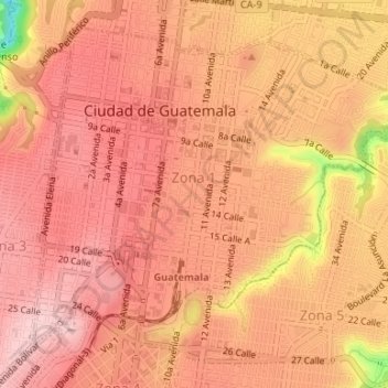
Name: Zone 1 topographic map, elevation, terrain.
Location: Zone 1, Guatemala City, Guatemala Department, Guatemala (14.62174 -90.52407 14.64932 -90.49092)
Average elevation: 4,885 ft
Minimum elevation: 4,429 ft
Maximum elevation: 5,033 ft
Thank you for supporting this site ❤️
Make a donation
Make a donation
Gear up for your next adventure:
As an Amazon Associate, this site earns from qualifying purchases at no extra cost to you.