
Dudweiler topographic map
Interactive map
Click on the map to display elevation.
About this map
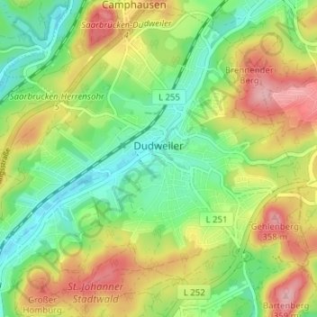
Name: Dudweiler topographic map, elevation, terrain.
Average elevation: 889 ft
Minimum elevation: 676 ft
Maximum elevation: 1,184 ft
Other topographic maps
Click on a map to view its topography, its elevation and its terrain.
Ensheim
Deutschland > Saarland > Saarbrücken
Ensheim, Bezirk Halberg, Saarbrücken, Regionalverband Saarbrücken, Saarland, 66131, Deutschland
Average elevation: 997 ft