
Mamoudzou topographic map
Interactive map
Click on the map to display elevation.
About this map
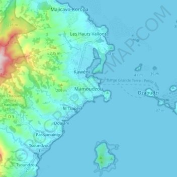
Name: Mamoudzou topographic map, elevation, terrain.
Location: Mamoudzou, Mayotte, 97600, France (-12.82041 45.18798 -12.74041 45.26798)
Average elevation: 174 ft
Minimum elevation: -3 ft
Maximum elevation: 1,634 ft