
Zebulon topographic map
Interactive map
Click on the map to display elevation.
About this map
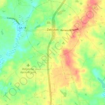
Name: Zebulon topographic map, elevation, terrain.
Location: Zebulon, Pike County, Georgia, 30295, United States (33.06233 -84.35950 33.11796 -84.32494)
Average elevation: 833 ft
Minimum elevation: 728 ft
Maximum elevation: 958 ft
Other topographic maps
Click on a map to view its topography, its elevation and its terrain.
Concord
United States > Georgia > Pike County
Concord, Pike County, Georgia, United States
Average elevation: 817 ft
Molena
United States > Georgia > Pike County
Molena, Pike County, Georgia, United States
Average elevation: 741 ft