Geolocate

Llanboidy topographic map

Click on the map to display elevation.

About this map

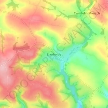
Name: Llanboidy topographic map, elevation, terrain.

Location: Llanboidy, Carmarthenshire, Wales, SA34 0EL, United Kingdom (51.85885 -4.61297 51.89885 -4.57297)

Average elevation: 449 ft

Minimum elevation: 190 ft

Maximum elevation: 669 ft

Other topographic maps

Click on a map to view its topography, its elevation and its terrain.

River Towy

United Kingdom > Wales > Carmarthenshire

Average elevation: 705 ft

Gear up for your next adventure:

🦶Hiking Gaiters - Keep debris and water out of your boots
🪶Wildlife Field Guides - Learn animal tracking and species ID
🎒Outdoor Daypacks - Lightweight backpacks designed for carrying maps and essential gear
GPS Sports Watch - GPS watch for running, hiking and training
🕶️Glacier Sunglasses - Side shields to protect eyes from high-altitude snow glare

As an Amazon Associate, this site earns from qualifying purchases at no extra cost to you.