
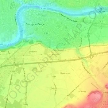
Les Bayannins topographic map
Interactive map
Click on the map to display elevation.
About this map
Name: Les Bayannins topographic map, elevation, terrain.
Average elevation: 587 ft
Minimum elevation: 440 ft
Maximum elevation: 758 ft
Other topographic maps
Click on a map to view its topography, its elevation and its terrain.
Le Pit
France > Auvergne-Rhône-Alpes > Drôme > Bourg-de-Péage > Le Pit
Le Pit, Bourg-de-Péage, Valence, Drôme, Auvergne-Rhône-Alpes, France métropolitaine, 26300, France
Average elevation: 617 ft
Les Drets
France > Auvergne-Rhône-Alpes > Drôme > Bourg-de-Péage
Les Drets, Bourg-de-Péage, Valence, Drôme, Auvergne-Rhône-Alpes, France métropolitaine, 26300, France
Average elevation: 587 ft