
亚运村街道 topographic map
Interactive map
Click on the map to display elevation.
About this map
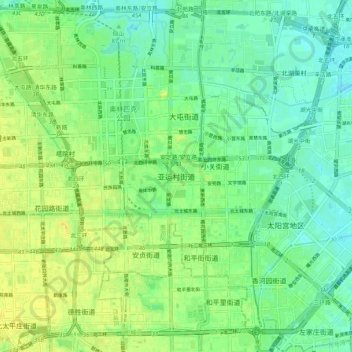
Name: 亚运村街道 topographic map, elevation, terrain.
Location: 亚运村街道, Chaoyang, Pékin, 100000, Chine (39.94348 116.36337 40.02348 116.44337)
Average elevation: 154 ft
Minimum elevation: 121 ft
Maximum elevation: 194 ft