Geolocate

Dededo topographic map

Click on the map to display elevation.

About this map

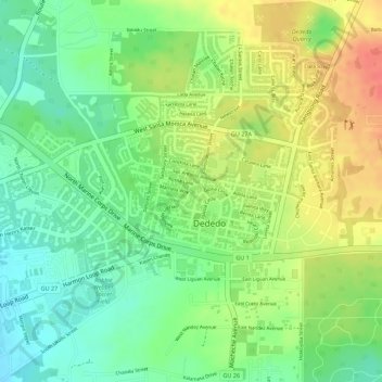
Name: Dededo topographic map, elevation, terrain.

Location: Dededo, Dededo Municipality, Guam, United States (13.51421 144.83120 13.52374 144.84460)

Average elevation: 325 ft

Minimum elevation: 230 ft

Maximum elevation: 433 ft

Guam trails, hiking, mountain biking, running and outdoor activities

Gear up for your next adventure:

🔌USB Car Charger - Car charger for on‑the‑go power needs
🧢Outdoor Hiking Hat - Sun protection hat for outdoor explorers
🧺Microfiber Travel Towels - Compact and fast-drying towels for trail use
🪑Ultralight Camp Chairs - Portable seating for resting after a long day of mapping
🌲Outdoor Survival Books - Best books on survival skills

As an Amazon Associate, this site earns from qualifying purchases at no extra cost to you.