
Point Barrow topographic map
Interactive map
Click on the map to display elevation.
About this map
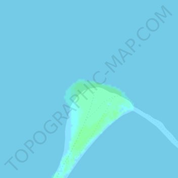
Name: Point Barrow topographic map, elevation, terrain.
Location: Point Barrow, North Slope, Alaska, United States (71.38647 -156.47419 71.38657 -156.47409)
Average elevation: 0 ft
Minimum elevation: 0 ft
Maximum elevation: 13 ft
Other topographic maps
Click on a map to view its topography, its elevation and its terrain.
Prudhoe Bay
United States > Alaska > North Slope
Prudhoe Bay, North Slope, Alaska, 99734, United States
Average elevation: 33 ft
Toolik Field Station
United States > Alaska > North Slope
Toolik Field Station, North Slope, Alaska, United States
Average elevation: 2,428 ft
Chandalar Shelf
United States > Alaska > North Slope
Chandalar Shelf, North Slope, Alaska, United States
Average elevation: 3,196 ft
Toolik River
United States > Alaska > North Slope
Toolik River, North Slope, Alaska, United States
Average elevation: 413 ft
Kaktovik
United States > Alaska > North Slope > Kaktovik
Kaktovik, North Slope, Alaska, 99747, United States
Average elevation: 16 ft
Deadhorse
United States > Alaska > North Slope
Deadhorse, North Slope, Alaska, 99734, United States
Average elevation: 46 ft
Utqiaġvik
United States > Alaska > North Slope
Utqiaġvik, North Slope, Alaska, 99273, United States
Average elevation: 13 ft