
Muttil topographic map
Interactive map
Click on the map to display elevation.
About this map
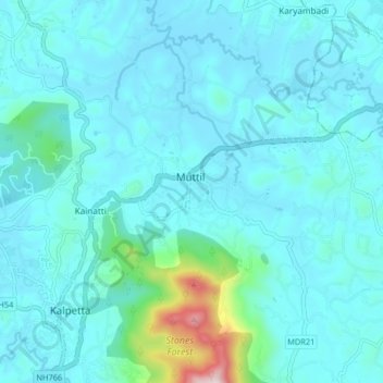
Name: Muttil topographic map, elevation, terrain.
Location: Muttil, Vythiri, Wayanad, Kerala, 673122, India (11.60148 76.07083 11.68148 76.15083)
Average elevation: 2,579 ft
Minimum elevation: 2,369 ft
Maximum elevation: 4,229 ft
Other topographic maps
Click on a map to view its topography, its elevation and its terrain.
Banasura Sagar Dam
Banasura Sagar Dam, Vythiri, Wayanad, Kerala, 670575, India
Average elevation: 2,457 ft