Geolocate

Muttil topographic map

Click on the map to display elevation.

About this map

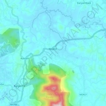
Name: Muttil topographic map, elevation, terrain.

Location: Muttil, Vythiri, Wayanad, Kerala, 673122, India (11.60148 76.07083 11.68148 76.15083)

Average elevation: 2,579 ft

Minimum elevation: 2,369 ft

Maximum elevation: 4,229 ft

Gear up for your next adventure:

🌡️Portable Weather Meter - Track weather conditions on the trail
🔥Plasma Lighters - Windproof lighters that work in any weather condition
🕶️Glacier Sunglasses - Side shields to protect eyes from high-altitude snow glare
🌄Hiking Binoculars - Compact binoculars for scenic views and trail spotting
👟Men's Trail Runners - Lightweight footwear for fast-paced exploration and light hiking

As an Amazon Associate, this site earns from qualifying purchases at no extra cost to you.