
Serowe topographic map
Interactive map
Click on the map to display elevation.
About this map
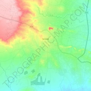
Name: Serowe topographic map, elevation, terrain.
Location: Serowe, Central District, Botswana (-22.45800 26.66753 -22.35293 26.78215)
Average elevation: 3,681 ft
Minimum elevation: 3,478 ft
Maximum elevation: 4,065 ft
Other topographic maps
Click on a map to view its topography, its elevation and its terrain.
Goshwe
Botswana > Central District > Goshwe
Goshwe, Central District, Botswana
Average elevation: 3,845 ft