
Neuhaus a.d.Pegnitz topographic map
Interactive map
Click on the map to display elevation.
About this map
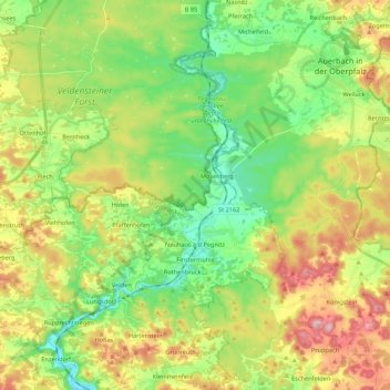
Name: Neuhaus a.d.Pegnitz topographic map, elevation, terrain.
Average elevation: 1,519 ft
Minimum elevation: 1,181 ft
Maximum elevation: 2,057 ft
Other topographic maps
Click on a map to view its topography, its elevation and its terrain.
Kolbenberg
Deutschland > Bayern > Landkreis Nürnberger Land > Neuhaus a.d.Pegnitz
Kolbenberg, Neuhaus a.d.Pegnitz, Landkreis Nürnberger Land, Bayern, 92275, Deutschland
Average elevation: 1,552 ft