
لولمان topographic map
Interactive map
Click on the map to display elevation.
About this map
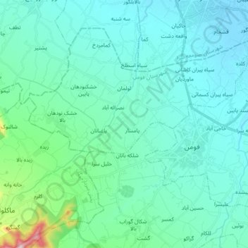
Name: لولمان topographic map, elevation, terrain.
Location: لولمان, بخش مرکزی, Fuman County, Gilan Province, Iran (37.20251 49.19365 37.27446 49.34866)
Average elevation: 167 ft
Minimum elevation: -16 ft
Maximum elevation: 1,270 ft