

Indianapolis topographic map
Click on the map to display elevation.
Indianapolis
Indianapolis is within the Tipton Till Plain, a flat to gently sloping terrain underlain by glacial deposits known as till. The lowest point in the city is about 650 feet (198 m) above mean sea level, with the highest natural elevation at about 900 feet (274 m) above sea level. Few hills or short ridges, known as kames, rise about 100 feet (30 m) to 130 feet (40 m) above the surrounding terrain. The city lies just north of the Indiana Uplands, a region characterized by rolling hills and high limestone content. The city is also within the EPA's Eastern Corn Belt Plains ecoregion, an area of the U.S. known for its fertile agricultural land.
About this map
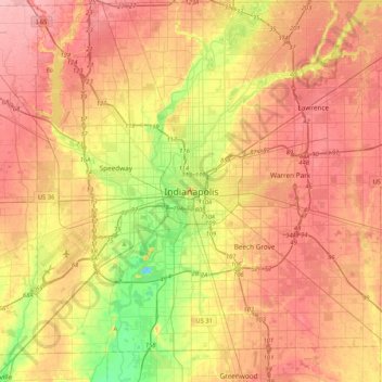
Name: Indianapolis topographic map, elevation, terrain.
Location: Indianapolis, Marion County, Indiana, 46204, United States (39.60833 -86.31835 39.92833 -85.99835)
Average elevation: 791 ft
Minimum elevation: 600 ft
Maximum elevation: 932 ft
Indiana trails, hiking, mountain biking, running and outdoor activities