Geolocate

Santa Ysabel topographic map

Click on the map to display elevation.

About this map

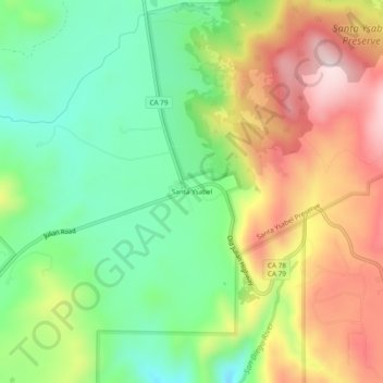
Name: Santa Ysabel topographic map, elevation, terrain.

Location: Santa Ysabel, San Diego County, California, United States (33.08921 -116.69308 33.12921 -116.65308)

Average elevation: 3,222 ft

Minimum elevation: 2,677 ft

Maximum elevation: 3,947 ft

San Diego County trails, hiking, mountain biking, running and outdoor activities

Gear up for your next adventure:

🔋Solar Power Banks - Keep your GPS and phone charged in remote wilderness areas
🧣Merino Neck Gaiters - Multi-functional headwear for wind and sun protection
🖼️Topo Map Wall Art - Decorative topographic prints of famous peaks and regions
🗺️NatGeo Topo Maps - High-quality waterproof printed topographic maps of US Parks
🥄Camping Utensil Set - Lightweight utensils for outdoor meals

As an Amazon Associate, this site earns from qualifying purchases at no extra cost to you.