Geolocate

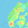
Løkken topographic map

Click on the map to display elevation.

About this map

Name: Løkken topographic map, elevation, terrain.

Location: Løkken, Hjørring Municipality, North Denmark Region, 9480, Denmark (57.35049 9.69125 57.39049 9.73125)

Average elevation: 13 ft

Minimum elevation: 0 ft

Maximum elevation: 62 ft

Other topographic maps

Click on a map to view its topography, its elevation and its terrain.

Skivum

Denmark > North Denmark Region

Average elevation: 105 ft

Pebermosen

Denmark > North Denmark Region > Grindsted > Vandsted

Average elevation: 128 ft

Læsø

Denmark > North Denmark Region

Average elevation: 3 ft

Lindholm Høje

Denmark > North Denmark Region > Aalborg

Average elevation: 46 ft

Vendsyssel

Denmark > North Denmark Region

Average elevation: 33 ft

Mors

Denmark > North Denmark Region

Average elevation: 39 ft

Bulbjerg

Denmark > North Denmark Region

Average elevation: 26 ft

Lille Vildmose

Denmark > North Denmark Region

Average elevation: 26 ft

Egholm

Denmark > North Denmark Region > Aalborg

Average elevation: 3 ft

Gear up for your next adventure:

🥾Hiking Shoes - Durable and comfortable shoes for trail hiking
🥾Women's Hiking Boots - Top-rated trail boots with ankle support and superior grip
🗺️Topographic Maps - Detailed topo maps for hiking, exploring and outdoor navigation
🎒Trail Energy Bars - High‑calorie bars for hiking energy
📌Outdoor GPS Map App - Apps and devices for digital topographic navigation

As an Amazon Associate, this site earns from qualifying purchases at no extra cost to you.