Geolocate

Ludres topographic map

Click on the map to display elevation.

About this map
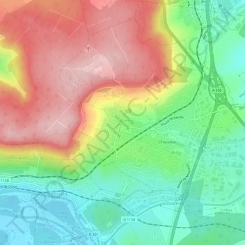
Name: Ludres topographic map, elevation, terrain.

Location: Ludres, Nancy, Meurthe-et-Moselle, Grand Est, Metropolitan France, 54710, France (48.60462 6.14569 48.63801 6.20456)

Average elevation: 1,014 ft

Minimum elevation: 712 ft

Maximum elevation: 1,381 ft

Other topographic maps

Click on a map to view its topography, its elevation and its terrain.

Lemont

France > Grand Est > Meurthe-et-Moselle > Cosnes-et-Romain

Average elevation: 1,191 ft

La Puce

France > Grand Est > Meurthe-et-Moselle > Boismont

Average elevation: 938 ft

Gear up for your next adventure:

📚Navigation Handbooks - Master the art of reading topographic maps and using a compass
🥾Men's Hiking Boots - Durable, waterproof footwear for rugged terrain and steep inclines
👖Convertible Hiking Pants - Versatile zip-off pants for changing altitudes and temperatures
🕶️Glacier Sunglasses - Side shields to protect eyes from high-altitude snow glare
📦Dry Bags Set - Waterproof storage for electronics and clothes

As an Amazon Associate, this site earns from qualifying purchases at no extra cost to you.