Geolocate

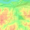
Graceland topographic map

Click on the map to display elevation.

About this map

Name: Graceland topographic map, elevation, terrain.

Location: Graceland, Memphis, Shelby County, West Tennessee, Tennessee, United States (35.04485 -90.02495 35.04707 -90.02123)

Average elevation: 285 ft

Minimum elevation: 236 ft

Maximum elevation: 318 ft

Shelby County trails, hiking, mountain biking, running and outdoor activities

Other topographic maps

Click on a map to view its topography, its elevation and its terrain.
The Village

United States > Tennessee > Shelby County > Memphis

Average elevation: 308 ft

Normal

United States > Tennessee > Shelby County > Memphis

Average elevation: 305 ft

Pisgah Heights

United States > Tennessee > Shelby County > Memphis

Average elevation: 256 ft

Lenox

United States > Tennessee > Shelby County > Memphis

Average elevation: 305 ft

Buntyn

United States > Tennessee > Shelby County > Memphis

Average elevation: 308 ft

River Oaks

United States > Tennessee > Shelby County > Memphis

Average elevation: 305 ft

Cordova

United States > Tennessee > Shelby County > Memphis

Cordova is a community in Shelby County, Tennessee, United States. Cordova lies east of Memphis, north of Germantown, south of Bartlett, and northwest of Collierville at an elevation of 361 feet (110 meters).

Average elevation: 325 ft

Cordova

United States > Tennessee > Shelby County > Memphis

Cordova is a community in Shelby County, Tennessee, United States. Cordova lies east of Memphis, north of Germantown, south of Bartlett, and northwest of Collierville at an elevation of 361 feet (110 meters).

Average elevation: 325 ft

Memphis

United States > Tennessee > Shelby County > Memphis

Average elevation: 279 ft

Foote Homes

United States > Tennessee > Shelby County > Memphis

Average elevation: 276 ft

Hedgemoor

United States > Tennessee > Shelby County > Memphis

Average elevation: 302 ft

Gear up for your next adventure:

🧭Map Reading Tools - Tools and kits for map navigation
🔭Stargazing Telescopes - Perfect for camping in low-light pollution areas shown on maps
📚Navigation Handbooks - Master the art of reading topographic maps and using a compass
🌎3D Topographic Globes - Raised relief globes for a tactile understanding of geography
🪵Folding Camp Saw - Compact saw for wood and campsite work

As an Amazon Associate, this site earns from qualifying purchases at no extra cost to you.