
Beaumat topographic map
Interactive map
Click on the map to display elevation.
About this map
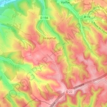
Name: Beaumat topographic map, elevation, terrain.
Average elevation: 1,155 ft
Minimum elevation: 771 ft
Maximum elevation: 1,407 ft
Other topographic maps
Click on a map to view its topography, its elevation and its terrain.
Les Canavals Hauts
France > Occitanie > Lot > Cœur de Causse
Les Canavals Hauts, Labastide-Murat, Cœur de Causse, Gourdon, Lot, Occitanie, France métropolitaine, 46240, France
Average elevation: 1,273 ft