Geolocate

Ivanivka topographic map

Click on the map to display elevation.

About this map

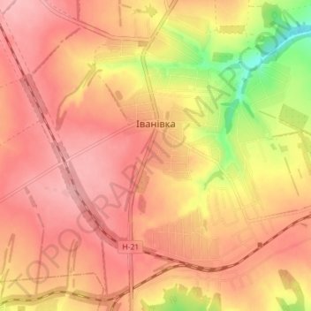
Name: Ivanivka topographic map, elevation, terrain.

Location: Ivanivka, Antratsyt Raion, Luhansk Oblast, 94644, Ukraine (48.20938 38.92319 48.25657 38.98172)

Average elevation: 1,066 ft

Minimum elevation: 807 ft

Maximum elevation: 1,188 ft

Gear up for your next adventure:

🥘Titanium Cookware - Durable, featherlight pots and pans for backpacking
🪑Portable Camp Table - Compact table for campsite meals
🪶Trail Camera - Capture wildlife on your hikes
🔊Portable Camp Speaker - Music and alerts at camp
🗺️Topographic Maps - Detailed topo maps for hiking, exploring and outdoor navigation

As an Amazon Associate, this site earns from qualifying purchases at no extra cost to you.