Geolocate

Ghuttu topographic map

Click on the map to display elevation.

About this map

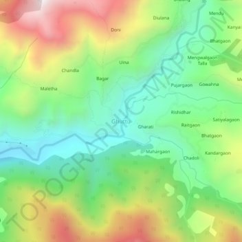
Name: Ghuttu topographic map, elevation, terrain.

Location: Ghuttu, Ghansali, Tehri Garhwal District, Uttarakhand, India (30.50890 78.77015 30.54890 78.81015)

Average elevation: 6,089 ft

Minimum elevation: 4,715 ft

Maximum elevation: 8,340 ft

Gear up for your next adventure:

🔥Plasma Lighters - Windproof lighters that work in any weather condition
🥘Titanium Cookware - Durable, featherlight pots and pans for backpacking
🦟Ultrasonic Repellers - Create a bug-free zone at your camp or rest stop
🧺Microfiber Travel Towels - Compact and fast-drying towels for trail use
🧷Carabiner Set - Durable clips for gear attachment

As an Amazon Associate, this site earns from qualifying purchases at no extra cost to you.