Geolocate

Mount Sumbing topographic map

Click on the map to display elevation.

About this map

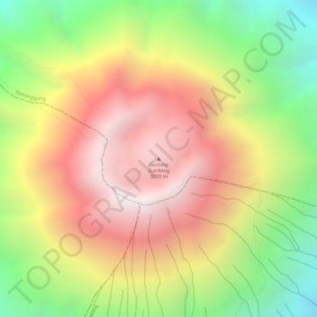
Name: Mount Sumbing topographic map, elevation, terrain.

Location: Mount Sumbing, Temanggung, Central Java, Java, Indonesia (-7.38194 110.07577 -7.38184 110.07587)

Average elevation: 9,321 ft

Minimum elevation: 7,441 ft

Maximum elevation: 10,869 ft

Gear up for your next adventure:

🪶Fire Starter Kit - Reliable fire starter for survival and camping
👖Convertible Hiking Pants - Versatile zip-off pants for changing altitudes and temperatures
🛡️Bear Spray Outdoor - Protection in bear country hikes
🪶LED Camping Lantern - Bright lantern for camp lighting
🪑Ultralight Camp Chairs - Portable seating for resting after a long day of mapping

As an Amazon Associate, this site earns from qualifying purchases at no extra cost to you.