Geolocate

Chiplun topographic map

Click on the map to display elevation.

About this map

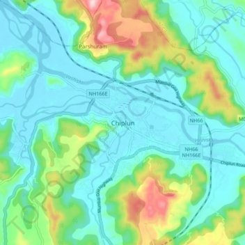
Name: Chiplun topographic map, elevation, terrain.

Location: Chiplun, Ratnagiri, Maharashtra, 415600, India (17.49303 73.47230 17.57303 73.55230)

Average elevation: 226 ft

Minimum elevation: -10 ft

Maximum elevation: 958 ft

Gear up for your next adventure:

🌄Hiking Binoculars - Compact binoculars for scenic views and trail spotting
🎒Waterproof Dry Bags - Keep your electronics and maps dry inside your pack
🔋Solar Power Banks - Keep your GPS and phone charged in remote wilderness areas
🪶Camp Gear Gift Set - Perfect gift bundle for outdoor fans
🧣Merino Neck Gaiters - Multi-functional headwear for wind and sun protection

As an Amazon Associate, this site earns from qualifying purchases at no extra cost to you.