
Greencastle topographic map
Interactive map
Click on the map to display elevation.
About this map
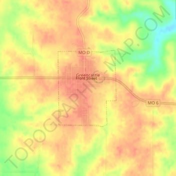
Name: Greencastle topographic map, elevation, terrain.
Location: Greencastle, Sullivan County, Missouri, United States (40.25463 -92.88401 40.26634 -92.87232)
Average elevation: 1,014 ft
Minimum elevation: 902 ft
Maximum elevation: 1,063 ft
Other topographic maps
Click on a map to view its topography, its elevation and its terrain.
Osgood
United States > Missouri > Sullivan County
Osgood, Sullivan County, Missouri, United States
Average elevation: 846 ft