Geolocate

Penne topographic map

Click on the map to display elevation.

About this map
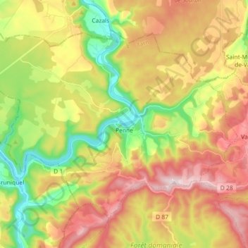
Name: Penne topographic map, elevation, terrain.

Location: Penne, Albi, Tarn, Occitania, Metropolitan France, 81140, France (44.03994 1.65270 44.11849 1.79565)

Average elevation: 942 ft

Minimum elevation: 322 ft

Maximum elevation: 1,611 ft

Other topographic maps

Click on a map to view its topography, its elevation and its terrain.
Le Bez

France > Occitania > Tarn > Mirandol-Bourgnounac

Average elevation: 1,224 ft

La Mothe

France > Occitania > Tarn > Castelnau-de-Lévis

Average elevation: 666 ft

Gear up for your next adventure:

📌Outdoor GPS Map App - Apps and devices for digital topographic navigation
🎒Trail Energy Bars - High‑calorie bars for hiking energy
🧭Hiking Compass - Precision compass for reliable navigation in the wilderness
🦺Reflective Outdoor Gear - Safety gear for low‑light conditions
🪑Ultralight Camp Chairs - Portable seating for resting after a long day of mapping

As an Amazon Associate, this site earns from qualifying purchases at no extra cost to you.