
Thank you for supporting this site ❤️
Make a donation
Make a donation
Gear up for your next adventure:
As an Amazon Associate, this site earns from qualifying purchases at no extra cost to you.
Yura topographic map
Click on the map to display elevation.
Thank you for supporting this site ❤️
Make a donation
Make a donation
Gear up for your next adventure:
As an Amazon Associate, this site earns from qualifying purchases at no extra cost to you.
About this map
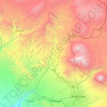
Name: Yura topographic map, elevation, terrain.
Location: Yura, Province of Arequipa, Arequipa, Peru (-16.39541 -71.90692 -15.92534 -71.28713)
Average elevation: 10,886 ft
Minimum elevation: 3,999 ft
Maximum elevation: 19,826 ft
Thank you for supporting this site ❤️
Make a donation
Make a donation
Gear up for your next adventure:
As an Amazon Associate, this site earns from qualifying purchases at no extra cost to you.