
Ernsbach topographic map
Interactive map
Click on the map to display elevation.
About this map
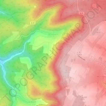
Name: Ernsbach topographic map, elevation, terrain.
Location: Ernsbach, Erbach, Odenwaldkreis, Hessen, 64711, Duitsland (49.63939 9.03786 49.67495 9.07457)
Average elevation: 1,467 ft
Minimum elevation: 892 ft
Maximum elevation: 1,798 ft
Other topographic maps
Click on a map to view its topography, its elevation and its terrain.
Rothenberg
Duitsland > Hessen > Odenwaldkreis
Rothenberg, Oberzent, Odenwaldkreis, Hessen, Duitsland
Average elevation: 1,129 ft