
郭镇 topographic map
Interactive map
Click on the map to display elevation.
About this map
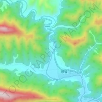
Name: 郭镇 topographic map, elevation, terrain.
Location: 郭镇, 略阳县, 汉中市, 陕西省, 中国, 乐素河 (33.31197 105.80153 33.34748 105.82932)
Average elevation: 3,901 ft
Minimum elevation: 3,392 ft
Maximum elevation: 5,075 ft
Other topographic maps
Click on a map to view its topography, its elevation and its terrain.