
Бутыль topographic map
Interactive map
Click on the map to display elevation.
About this map
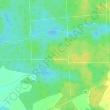
Name: Бутыль topographic map, elevation, terrain.
Average elevation: 486 ft
Minimum elevation: 453 ft
Maximum elevation: 528 ft
Other topographic maps
Click on a map to view its topography, its elevation and its terrain.
Сосновый
Беларусь > Гомельская область > Мозырский район > Каменский сельский Совет
Сосновый, Каменский сельский Совет, Мозырский район, Гомельская область, Беларусь
Average elevation: 554 ft