
Thank you for supporting this site ❤️
Make a donation
Make a donation
Gear up for your next adventure:
As an Amazon Associate, this site earns from qualifying purchases at no extra cost to you.
Kösedağ topographic map
Click on the map to display elevation.
Thank you for supporting this site ❤️
Make a donation
Make a donation
Gear up for your next adventure:
As an Amazon Associate, this site earns from qualifying purchases at no extra cost to you.
About this map
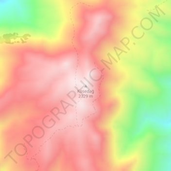
Name: Kösedağ topographic map, elevation, terrain.
Location: Kösedağ, Suşehri, Sivas, Central Anatolia Region, Turkey (40.05667 38.09872 40.05677 38.09882)
Average elevation: 6,850 ft
Minimum elevation: 5,423 ft
Maximum elevation: 7,671 ft
Thank you for supporting this site ❤️
Make a donation
Make a donation
Gear up for your next adventure:
As an Amazon Associate, this site earns from qualifying purchases at no extra cost to you.