
Pyburn topographic map
Interactive map
Click on the map to display elevation.
About this map
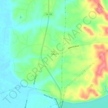
Name: Pyburn topographic map, elevation, terrain.
Location: Pyburn, Hardin County, Tennessee, 38365, USA (35.07120 -88.27421 35.11120 -88.23421)
Average elevation: 476 ft
Minimum elevation: 374 ft
Maximum elevation: 673 ft