
Les Flogères topographic map
Interactive map
Click on the map to display elevation.
About this map
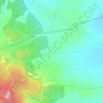
Name: Les Flogères topographic map, elevation, terrain.
Average elevation: 531 ft
Minimum elevation: 387 ft
Maximum elevation: 886 ft
Other topographic maps
Click on a map to view its topography, its elevation and its terrain.
La Noue du Roi
Frankrijk > Grand Est > Marne > Berru
La Noue du Roi, Berru, Reims, Marne, Grand Est, Metropolitaans Frankrijk, 51420, Frankrijk
Average elevation: 627 ft