
Rio Levya topographic map
Interactive map
Click on the map to display elevation.
About this map
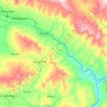
Name: Rio Levya topographic map, elevation, terrain.
Location: Rio Levya, San Nicolás, Rodríguez de Mendoza, Amazonas, Perú (-6.48406 -77.52152 -6.40069 -77.37963)
Average elevation: 5,991 ft
Minimum elevation: 4,180 ft
Maximum elevation: 8,451 ft