
Rasquera topographic map
Interactive map
Click on the map to display elevation.
About this map
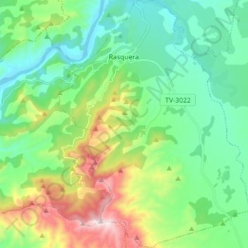
Name: Rasquera topographic map, elevation, terrain.
Location: Rasquera, Ribera d'Ebre, Tarragona, Catalonië, 43513, Spanje (40.93072 0.56529 41.02507 0.66591)
Average elevation: 860 ft
Minimum elevation: 26 ft
Maximum elevation: 2,992 ft
Other topographic maps
Click on a map to view its topography, its elevation and its terrain.
Castellons
Spanje > Catalonië > Ribera d'Ebre > Flix
Castellons, Flix, Ribera d'Ebre, Tarragona, Catalonië, 43750, Spanje
Average elevation: 233 ft