
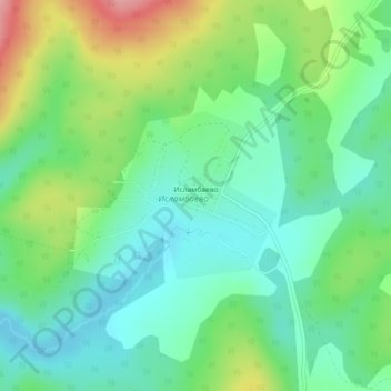
Исламбаево topographic map
Interactive map
Click on the map to display elevation.
About this map
Name: Исламбаево topographic map, elevation, terrain.
Average elevation: 1,883 ft
Minimum elevation: 1,752 ft
Maximum elevation: 2,156 ft
Other topographic maps
Click on a map to view its topography, its elevation and its terrain.
Старомусятово
Russie > Bachkortostan > Бурзянский район
Старомусятово, Старосубхангуловский сельсовет, Бурзянский район, Bachkortostan, District fédéral de la Volga, 453584, Russie
Average elevation: 1,470 ft