Geolocate

Kapatalan topographic map

Click on the map to display elevation.

About this map

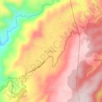
Name: Kapatalan topographic map, elevation, terrain.

Location: Kapatalan, Siniloan, Laguna, Calabarzon, Philippines (14.46254 121.48097 14.50254 121.52097)

Average elevation: 1,122 ft

Minimum elevation: 233 ft

Maximum elevation: 1,591 ft

Gear up for your next adventure:

🪶Multi‑Purpose Knife - Useful blade for camp and trail
🧷Carabiner Set - Durable clips for gear attachment
🥩Freeze-Dried Meals - Nutritious and lightweight food for remote expeditions
🎒Gear Packing Cubes - Organize your backpack efficiently
🧢Sun Protection Hats - Wide-brimmed and UPF-rated hats for high-altitude sun safety

As an Amazon Associate, this site earns from qualifying purchases at no extra cost to you.