
Ksar Temassekht topographic map
Interactive map
Click on the map to display elevation.
About this map
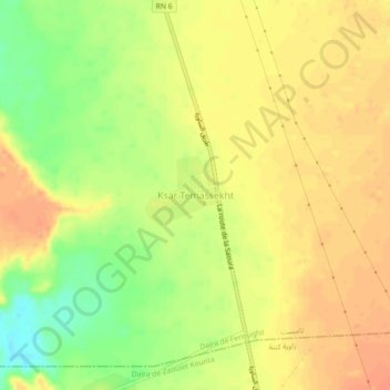
Name: Ksar Temassekht topographic map, elevation, terrain.
Location: Ksar Temassekht, Tamest, Daïra de Fenoughil, Adrar, Algérie (27.33759 -0.24392 27.37759 -0.20392)
Average elevation: 771 ft
Minimum elevation: 682 ft
Maximum elevation: 817 ft
Other topographic maps
Click on a map to view its topography, its elevation and its terrain.
Tamentit
Algérie > Adrar > Daïra de Fenoughil
Tamentit, Daïra de Fenoughil, Adrar, 1038, Algérie
Average elevation: 886 ft
Fenoughil
Algérie > Adrar > Daïra de Fenoughil
Fenoughil, Daïra de Fenoughil, Adrar, 00100, Algérie
Average elevation: 984 ft
Tamest
Algérie > Adrar > Daïra de Fenoughil > Tamest
Tamest, Daïra de Fenoughil, Adrar, 01028, Algérie
Average elevation: 968 ft