Geolocate

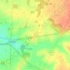
Cannes-Écluse topographic map

Click on the map to display elevation.

About this map
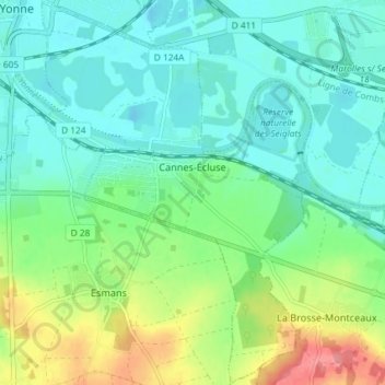
Name: Cannes-Écluse topographic map, elevation, terrain.

Location: Cannes-Écluse, Provins, Seine-et-Marne, Ile-de-France, Metropolitan France, 77130, France (48.33653 2.96342 48.38502 3.01459)

Average elevation: 220 ft

Minimum elevation: 148 ft

Maximum elevation: 407 ft

Other topographic maps

Click on a map to view its topography, its elevation and its terrain.

E

France > Ile-de-France > Seine-et-Marne > Limoges-Fourches

Average elevation: 299 ft

Le Tillet

France > Ile-de-France > Seine-et-Marne > Reuil-en-Brie

Average elevation: 384 ft

Parc du Moulin

France > Ile-de-France > Seine-et-Marne > Chelles

Average elevation: 144 ft

Freebooter Falls

France > Ile-de-France > Seine-et-Marne > Chessy

Average elevation: 384 ft

Gear up for your next adventure:

🦟Ultrasonic Repellers - Create a bug-free zone at your camp or rest stop
🌎3D Topographic Globes - Raised relief globes for a tactile understanding of geography
🔦LED Headlamp - Bright and durable LED headlamp for night navigation
🏕️Family Camping Gear - Essentials for group camping trips
🔭Stargazing Telescopes - Perfect for camping in low-light pollution areas shown on maps

As an Amazon Associate, this site earns from qualifying purchases at no extra cost to you.